Causes, Importance And Prediction of Flood

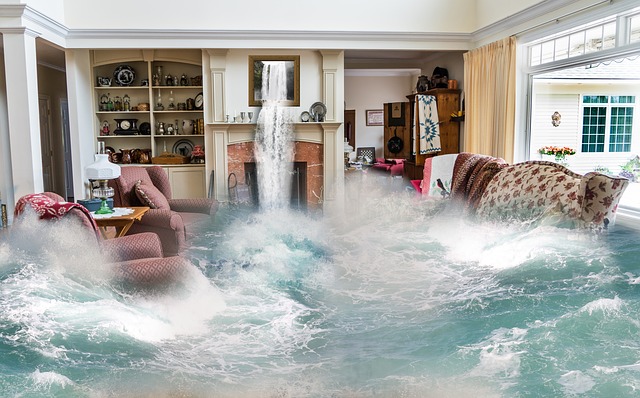
Flood is a natural even which has always been an integral part of geological history of earth. It occurs along rivers, streams and lacks.
Importance of flood:
- Most of the hydraulics are designed on flood records.
- Small hydraulic structures are based on a minimum of 25 years of flood records e.g. all structures constructed in the canal, soil conservation practices, etc.
- Medium-type structures are mainly based on 50 years of flood records e.g. culverts, drainage structures, and waterway structures.
- Large irrigation projects are based on 100 years of flood records e.g. Dams, reservoirs, headworks, and barrages.
Causes of floods:
Intensive rainfall and high melting of snow are the two main causes of floods.
Factors Affecting flood
Meteorological factors
- Intensive Rainfall: High-intensity rainfall can lead to floods. When the rainfall exceeds the infiltration capacity of the soil or the capacity of rivers and drainage systems to handle the increased water volume, it can result in flooding.
- Form of Precipitation: The form of precipitation, such as rain, snowmelt, or hail, can influence the flood risk. Rapid snowmelt, for example, can cause a sudden surge in water levels and lead to flooding.
Physiological factors
These factors are given as follows
- Main made activity (Afforestation and deforestation)
- The removal of vegetation, such as deforestation, can reduce the natural water-holding capacity of the land and increase surface runoff, contributing to flooding. Conversely, afforestation (planting trees) can help mitigate floods by enhancing infiltration and reducing runoff.
- Intensive rainfall:
- High flood occurs due to intensive rainfall.
- Slope of the Catchment
- The steepness of the catchment area or watershed affects the rate at which water flows into rivers and streams. Steeper slopes can lead to faster runoff and increase the likelihood of flooding.
- Magnitude of Catchment
- The size and extent of the catchment area can influence the volume of water entering the river system. Larger catchments can contribute more water, increasing the flood risk.
- Soil type
- The soil's permeability, water-holding capacity, and infiltration rate influence how quickly water is absorbed or runs off the surface. Impermeable soils or those with low infiltration rates are more prone to runoff, leading to increased flooding.
- Catchment shape
- The shape of the catchment area affects the concentration and flow of water. Catchments with narrow valleys or converging slopes can concentrate runoff and exacerbate flood conditions.
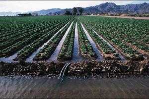
- Improved drainage system/poor drainage system
- Inadequate or poorly maintained drainage systems can impede the efficient flow of water and exacerbate flooding. Insufficient capacity, blockages, or inadequate maintenance can result in waterlogging and increased flood risk.
- Climatic changes
- Changes in climate patterns, such as increased frequency or intensity of rainfall events, can contribute to higher flood risks. Climate change can alter precipitation patterns, temperature, and weather systems, leading to more frequent or severe flooding events.
- Form of precipitation.
- Water Logging
- Waterlogging occurs when the ground becomes saturated and cannot absorb or drain excess water. Factors such as high groundwater levels, poor soil drainage, or inadequate surface runoff pathways can contribute to waterlogging and increase the potential for flooding.
Control of flood:
- Check on deforestation and well-planned watershed management project
- Check dams and reservoirs
- Distribution of water at various streams
- Empowering drainage system
- Decrease waterlogging
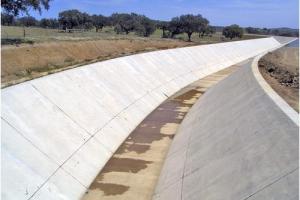
- Construction of levees and improvement of steams
Prediction and Flood Estimation:
No method is available for knowing the exact amount and intensity of rainfall by which flood can be determined. Similarly, rainfall and flood prediction cannot be performed but with a certain precision. The expected flood and its consequent damage can only be judged and appointed and hence while designing flood protection and judgment of the design engineer is of utmost importance.
Some methods are based on basic characteristics and others are based on the theory of probability by using previous flood data and some others are based on the study of rainfall and runoff data. From marks of height flood on rivers bank, the area of flow the Wetted parameter and slope can be found.
Peak discharge can be calculated from Manning Eq. Q = 1/n R2/3 S ½ A
Methods for Prediction of Flood and Flood Estimation
Methods for prediction and flood estimation involve various techniques and data sources to assess and forecast potential flooding events. Here are some commonly used methods:
1. Hydrological Modeling:
Hydrological models simulate the behavior of a river basin by considering various factors such as rainfall, evaporation, soil characteristics, land use, and topography. These models help estimate river flows and water levels, allowing for flood prediction. Examples of hydrological models include the HEC-HMS (Hydrologic Engineering Center-Hydrologic Modeling System) and SWAT (Soil and Water Assessment Tool).
2. Rainfall-Runoff Models:
Rainfall-runoff models are used to simulate the transformation of rainfall into runoff, taking into account factors such as soil moisture, infiltration, and surface runoff. These models provide insights into how rainfall events contribute to flooding and help estimate peak flows. Examples include the SCS (Soil Conservation Service) Curve Number method and the NRCS (Natural Resources Conservation Service) unit hydrograph method.
3. Weather Forecasting:
Advanced weather forecasting techniques, such as numerical weather prediction models, satellite imagery, and radar data, are employed to predict rainfall patterns and intensities. These forecasts can provide valuable information on potential heavy rainfall events and their impact on flood generation.
4. Remote Sensing:
Remote sensing techniques, including satellite imagery and aerial photography, are used to monitor and analyze various aspects of the landscape, such as land cover changes, vegetation indices, and soil moisture content. This information aids in flood prediction and estimation by identifying areas susceptible to flooding.
5. Real-Time Monitoring:
Real-time monitoring systems play a crucial role in flood prediction and estimation. They involve the use of gauges, streamflow sensors, weather stations, and telemetry systems to continuously measure and transmit data on rainfall, river levels, and other relevant parameters. This data helps monitor current conditions, detect rising water levels, and provide early warning systems for potential floods.
6. Historical Data Analysis:
Analyzing historical flood data, including river gauges, flood maps, and past flood events, helps in understanding the behavior and patterns of floods in a particular region. Statistical methods, such as frequency analysis, can be applied to estimate the probability of future flood events based on historical records.
7. Ensemble Forecasting:
Ensemble forecasting combines multiple weather or hydrological models, considering different initial conditions and model configurations, to generate a range of possible flood scenarios. This approach provides a probabilistic outlook, indicating the likelihood of different flood magnitudes and the associated uncertainties.
8. Geographic Information System (GIS) Analysis:
GIS technology is utilized to integrate and analyze various spatial data layers, including elevation, land use, soil types, and drainage networks. GIS enables the identification of flood-prone areas, the assessment of flood impacts, and the development of flood hazard maps.
These methods are often used in combination, taking advantage of the strengths and limitations of each approach. The integration of different data sources, modeling techniques, and expert knowledge helps improve flood prediction accuracy and provides valuable information for flood management and emergency response planning.