Introduction to GeoInformatics - Branches and Applications

Geo-informatics is the science and art of
- Measuring
- Storing
- Organizing
- Analyzing
- Visualizing data related to phenomena occurring on or near the earth’s surface. For analyzing information related to earth
Geoinformatics combines:
- Geospatial analysis
- Modeling
- Geospatial databases
- Human-computer interaction
- Both wired and wireless networking technologies
Applications Of Geo-Informatics
Many fields benefit from geoinformatics, few of them includes
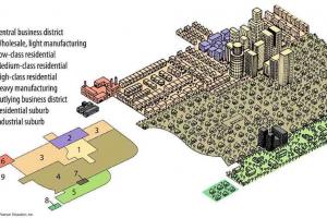
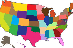
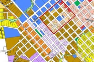
- Urban planning and land use management
- Tourism
- Virtual globes
- Local and national gazetteer management
- Environmental modeling and analysis
- Military
- Transport network planning and management
- Agriculture
- Meteorology and climate change
- Telecommunications
Branches of GeoInformatics
- Cartography
- Geodesy
- Geographic Information Systems
- Global Navigation Satellite Systems
- Photogrammetry
- Remote Sensing
- Web Mapping
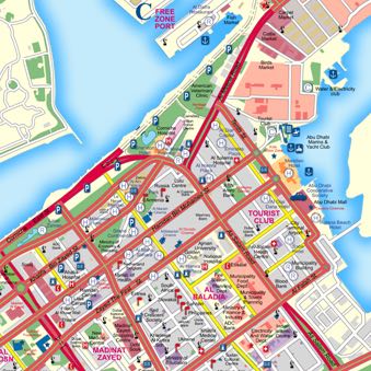
Cartography
Study and Practice of making maps
Geodesy
The scientific discipline that deals with the measurement and representation of the Earth.
Geographic Information Systems
A system that captures, stores, analyzes, manages and presents data with reference to geographic location data
Global navigation Satellite Systems
A system of satellites that provide autonomous geo-spatial positioning with global coverage.
Photogrammetry (Click to read More about this topic)
The practice of determining the geometric properties of objects from photographic images.
Remote Sensing
The acquisition of information about an object or phenomenon, without making physical contact with the object.
WEB MAPPING
The process of designing, implementing, generating and delivering maps on the World Wide Web.
ArcGIS
It is a suite consisting of a group of Geographic Information Systems (GIS) software products produced by ESRI (Environmental Systems Research Institute)
ESRI (Environmental Systems Research Institute)
It is a software development and services company providing Geographic Information System (GIS) software and Geo-database management applications. The headquarters of ESRI is in Redlands, California. ESRI uses the name ArcGIS to refer to its suite of GIS software products, which operate on desktop, server, and mobile platforms.
ArcGIS
ArcGIS includes the following Windows desktop software:
- Arc Reader
- ArcGIS Desktop
- ArcView
- Arc Editor
- Arc Info
Arc Reader
It is software providing some basic tools for
- Map viewing
- Printing
- Querying of spatial data
ArcView
It is software providing some basic tools for
- Map viewing
- Printing
- Querying
- Editing of spatial data
Arc Editor & Arc Info
- Arc Editor is used for mid-level editing of spatial data
- Arc Info is for high-level editing