Factors Affecting Selection of UUL Technologies

Underground Utility Locating Technologies
Accurate underground utility locating is crucial for safe and efficient construction projects. However, the accuracy of asset-locating methods can be influenced by several factors. By understanding these factors, project managers and surveying crews can make informed decisions about the selection and application of appropriate locating technologies. This comprehensive guide explores the key factors affecting the accuracy of asset-locating methods and provides insights into their significance.
Every underground utility locating technology has its own limitations. There is no single technology that can be used for every type of utility, soil type, and site. Many factors, including characteristics of expected underground utilities, geological conditions at the site, environmental and social factors, and experience of the operators should be considered as criteria for the appropriate selection of technologies.
- Type of Surveyed Utility
- Material of Surveyed Utility
- Depth of Surveyed Utility
- Internal Condition of Surveyed Utility
- Access to Surveyed Utility
- Type of Soil at Survey Site
- Ground Surface Cover of the Survey Site
- Utility Density at the Survey Site
- Experience and Knowledge of the Crew
Type of Surveyed Utility
- Different locating technologies have varying levels of accuracy depending on the type of utility being surveyed.
- The acoustic or thermal characteristics of the surveyed utilities dictate the accuracy of the locating surveys in parallel with other factors.
- Acoustic surveys can be used effectively for water and gas pipelines, which create vibrations that can be captured by a receiver.
- Thermal surveys can be used only for warm utilities such as sanitary sewers and high-voltage power lines to detect anomalies in the temperature field from the surrounding ground.
Material of Surveyed Utility
- Some locating techniques are limited or more effective for specific materials.
- A limited number of locating technologies are available for nonmetallic utilities. Magnetic surveys are not applicable to nonferrous metallic materials such as copper, plastic, and concrete materials, but are applicable to ferrous metallic materials, including steel, cast iron, and ductile iron.
- Electromagnetic methods, such as ground penetrating radar (GPR) or the terrain-conductive survey, have great benefits that can locate both metallic and non-metallic materials.
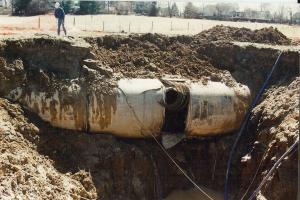
Depth of Surveyed Utility
- The depth at which the utility is buried affects the accuracy of locating methods. Signal penetration decreases with increasing depths, resulting in decreased resolution and accuracy. Metal detectors have limited depth capabilities of less than 0.6 meters, while pipe and cable locators can reach depths of up to 5 meters. Acoustic surveys' applicable depth varies depending on the target utilities.
Internal Condition of Surveyed Utility
- The internal condition of utilities, such as fill levels and flowing materials, impacts the accuracy of certain locating methods.
- Specific techniques, such as acoustic surveys, work better depending on the fill levels of utilities. As Acoustic surveys rely on pressure to transport sound waves, they are more effective when pipelines are filled with water or gas.
- Gravity surveys can detect density anomalies caused by underground pipelines, with empty water pipelines being more detectable due to the density difference with surrounding soils.
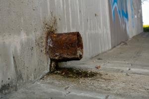
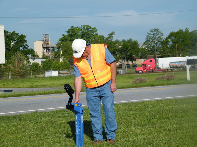
Access to Surveyed Utility
-
Site accessibility can influence the accuracy of surveys. Some locations may require traffic control or have limited physical access, which should be considered when selecting the most efficient and accurate locating technologies.
-
Additionally, techniques like acoustic surveys may require knowledge of surface appurtenances to ensure the proper introduction of sound waves into the utility.
Type of Soil at Survey Site
- Soil properties directly affect the penetration depth and accuracy of locating signals.
- High conductivity in clays or saturated sand hinders the penetration of GPR signals to less than 1 meter, while low-conductivity soil allows for deeper penetration.
- Terrain-conductive methods are effective in highly conductive soils, while resistivity methods work well in highly resistive soils.
Ground Surface Cover of the Survey Site
- Many underground utilities are buried under surface pavements with asphalt or reinforced concrete, which limits the penetration of electromagnetic signals.
- Acoustic surveys and thermal surveys also may have some difficulty capturing vibration and heat flux depending on the cover of the surveyed site.
Utility Density at the Survey Site
- The proximity and density of nearby buried objects may interfere with the accuracy of the surveys. Locating technologies need to be carefully evaluated for such sites.
- High utility density increases the possibility of accidents because of hitting the utilities.
- Surrounding ferrous features, such as guardrails, can significantly affect the accuracy of certain magnetic or resistivity surveys.
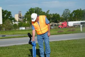
Experience and Knowledge of the Survey Crew
- Qualified underground utility locating consultants that are both knowledgeable and experienced with all applicable geophysical techniques are necessary for surveying underground utilities and interpreting the results of the surveys.
- The accuracy in the application of underground locating technologies and interpretation of survey results are greatly influenced by the experience and knowledge of the surveying crew.
- Surveying crews should be able to effectively evaluate the site conditions, capabilities, and limitations of the locating technologies for accurate surveys
By considering these factors, project managers and surveying crews can optimize the accuracy of asset locating methods,