Surveying Dictionary Words Starting from C
Cadastre
A public register of land recording the extent and value of land parcels for the purposes A dataset containing information related to land ownership and rights. This usually takes the form of maps and descriptions of uniquely identifiable land parcels. For each parcel, legal information such as ownership, easements and mortgages are recorded more information can be found on the HMLR web site.
Calibration
The act or process of comparing certain specific measurements in an instrument with a standard.
Canal
Artificial open channel for waterway purposes.
Cardinal
North, South, East or West directions only.
Cartesian Coordinates
Numbers expressing the location of a point in two or three dimensions as the perpendicular distances from two or three orthogonal axes.
Cadastral
A Latin term from 'cadastre' referring to a registry of lands. Cadastral surveying is the process of determining and defining land ownership and boundaries.
Cadastral map
A map depicting land parcels and associated nomenclature.
Centerline, center of
Line or point of equal division or separation.
Chart
Special purpose navigation maps chiefly used for nautical, aeronautical and mapping of the cosmos.
Choropleth Map
A class of thematic map portraying area properties using shaded symbols. Common choropleth maps are population maps.
Chain
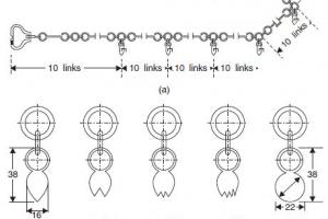
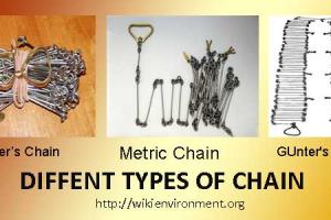
Unit of lineal measure equal to 66 feet.
Change Point
Change points are points of measurement which are used to carry the measurements forward in a run. Each one will be read first as a foresight, the instrument position is changed, and then it will be read as a backsight.
CISP
The Computer Inventory of Survey Plans is a database that provides current and historical survey plan information. It includes images of all survey plans registered in Queensland.
Climatic factor (C factor - WEQ)
Characterizes climatic erosivity, specifically wind speed and surface soil moisture. The factor for any given locality is expressed as a percentage of the C factor for Garden City, Kansas, which has a value of 100.
Clinometer
An instrument used to determine the angle of elevation or depression. A De Lisle's Pendent Clinometer was used by surveyors and engineers to set out slopes and gradients in the construction of paths, tracks and roads.
Close
A close is the difference between the starting level of the initial point for the outward run and that determined at the end of the return run. If the levels have been reduced correctly this value should be the same as the difference between the sum of the rises and falls and also the difference between the sum of the backsights and foresights.
Compass
The magnetic compass has a pivoting magnetised needle that always points to magnetic north (geological features may influence readings). The compass circumference is divided into degrees from which a bearing of a chosen direction from magnetic north can be determined. A compass magnetic bearing must be converted to a grid bearing for plotting on a map.
Contour interval
The difference in elevation between adjacent contours as delineated on a map.
Contours
Lines joining points of equal height as shown on a topographic map. Contour lines that are relatively close together depict an area of steep terrain on the earth's surface.
Coincident Line Feature
A feature derived from the merging of vectors from the same or different features, having coincident or near coincident alignments (as determined by a set tolerance) and feature code. Coincident features carrying certain feature codes constituting different thematic layers are not merged e.g. boundaries and landform.
Conflation
The process whereby two maps of the same area, usually from different time periods or different themes, can be matched and merged together.
Contiguous
Literally adjacent, touching. In the context of digital mapping, the word has a special meaning and implies a connected entity.
Control
A system of points which are used as fixed references for positioning other surveyed features.
Conventional Archive
Map information stored in non-digital form e.g. on paper. The conventional archive exists in a very wide range of formats which reflect differences in the methods used to gather the information, differences in the product items which are produced from the archival information and also differences in production techniques which have been adopted over the years.
Coordinate Geometry
Algorithms for handling basic two and three dimensional vector entities built into all surveying, mapping and GIS software.
Coordinate Pair
An X and Y value measured with reference to Cartesian axes. In mapping, a coordinate pair normally consists of an easting and a northing.
Coordinate Transformation
The computational process of converting an image or map from one co-ordinate system to another. Is also known as a transformation.
Coordinates
Pairs of numbers expressing horizontal distances along orthogonal axes, or triplets of numbers measuring horizontal and vertical distances.
Complementary Angle
Remnant angle of 90 degrees less smaller angle.
Corner
Juncture of intersecting lines; locative point.
Course
Line or boundary defined by bearing and distance.
Cropland
A Land cover/use category that includes areas used for the production of adapted crops for harvest. Two subcategories of cropland are recognized: cultivated and uncultivated. Cultivated cropland comprises land in row crops or close-grown crops and also other cultivated cropland, for example, hayland or pastureland that is in a rotation with row or close-grown crops. Uncultivated cropland includes permanent hayland and horticultural cropland.
Control Points
Control Points are fixed points of known coordinates. Such information can give only elevation or can include all coordinates. Control points are determined by high-accuracy surveys. In a less rigorous sense, control points for a construction project can be established conveniently around the project area using high-accuracy procedures. Such points would then be used throughout the project for referencing subsequent survey work, such as locating foundations, pipes, etc.
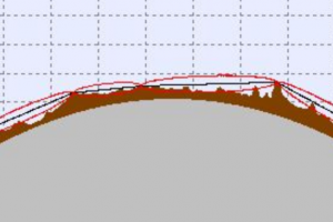
Crest
Highest elevation, uppermost level or height of.
CSM
Certified Survey Map abbreviation
Cut Tape
A cut tape has the last major division at the head subdivided into finer graduations, usually in tenths of a foot (or meter), sometimes in hundredths. The use of this tape requires that the minor reading be subtracted from the major division reading. Some tapes have minor divisions at both the head and tail.


