Physical Features of the Earth

Major physical features of the earth
Definition of Physical Features
Physical features refer to the natural characteristics and elements of a particular geographical area. They include various aspects such as mountains, rivers, slopes, plains, and other landforms. These features are essential for understanding the topography and geography of a region.
- The physical features map includes the existence of the:
- Mountains
- Rivers
- Slope or plain area
- The atmospheric study consists of:
- The average temperature of the site
- Average rainfall
- The climate of the area
- Wind and floods
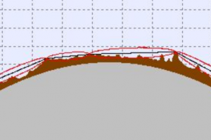
- Contours:
- Contours are lines on a map joining areas of equal elevation.
- These provide a bird's eye view of the topography of the area.
- Soil types:
The study of soil types in an area includes:
- Agricultural practices
- Fertility of soil
- Desertification
- Forestry
Mountains:
These are elevated landforms that rise prominently above the surrounding areas. They are typically characterized by steep slopes and peaks. Mountains play a crucial role in shaping the landscape and influencing local climates.
Rivers:
Rivers are large natural watercourses that flow from higher elevations to lower elevations. They are formed by the accumulation of rainfall and runoff from streams and tributaries. Rivers are vital for the distribution of water, transportation, and the formation of valleys and deltas.
Slope or plain area:
Slopes refer to inclined surfaces or gradients on the land. They can range from gentle slopes to steep inclines. Plains, on the other hand, are flat or gently rolling areas without significant variations in elevation. The slope and plain areas impact water drainage, agriculture, and human settlement patterns.
Atmospheric study pertains to the examination of weather and climate conditions in a specific area. It includes various factors such as:
Average temperature:
This refers to the mean temperature observed in a region over a specific period. It provides insights into the overall climatic conditions and seasonal variations.
Average rainfall:
This indicates the average amount of precipitation received in a particular area during a given time frame. It is an important factor for understanding water availability and the suitability of the region for agriculture.
Climate of the area:
Climate represents the long-term weather patterns and atmospheric conditions of a place. It includes factors such as temperature range, precipitation patterns, and prevailing winds. Climate classification systems, such as the Köppen climate classification, are used to categorize different regions based on their climate characteristics.
Wind and floods:
Wind patterns and flood occurrences are crucial elements of the atmospheric study. Wind direction and intensity influence weather conditions and can have significant effects on local ecosystems. Floods are natural disasters caused by excessive rainfall, river overflow, or other factors. Understanding these phenomena is vital for disaster preparedness and land-use planning.
Contour Lines
Contours are lines on a map that connect points of equal elevation. They provide a visual representation of the topography and terrain relief of an area. Contour lines allow us to understand the shape, height, and steepness of landforms, such as hills, valleys, and plateaus.
Soil Types:
Soil types refer to the different classifications and characteristics of soils found in a particular area. The study of soil types involves analyzing factors such as soil composition, texture, fertility, and drainage properties. Understanding the soil types in an area is crucial for various purposes:
Agricultural practices:
Different crops and plants have specific soil requirements. By studying soil types, farmers can determine the suitability of land for various agricultural activities and select appropriate crops accordingly.
Fertility of soil:
Soil fertility refers to its ability to support plant growth and provide essential nutrients. Soil type analysis helps in assessing fertility levels, determining suitable fertilization methods, and improving agricultural productivity.
Desertification:
Soil degradation and desertification are significant environmental concerns. By studying soil types, scientists and policymakers can identify areas at risk of desertification and implement appropriate measures for soil conservation and land management.
Forestry:
Soil types influence the growth and health of forests. Understanding soil characteristics helps in selecting appropriate tree species for afforestation, managing forest ecosystems, and implementing sustainable forestry practices.
Overall, studying physical features, atmospheric conditions, contours, and soil types provides valuable insights for land use planning, resource management, environmental conservation, and various other disciplines related to the natural environment.