Planning and Design of Large Dams
Stages of Dam Construction
Planning and Design of Dams is carried out in the following stages:
- Initial screening is conducted based on river profile and topographic maps.
- Reconnaissance plan is developed using only already available data.
- Pre-feasibility plan is developed with a little exploration and additional field data
- Feasibility plan is developed with extensive exploration and collection of additional field data
- Design stage: point tests/surveys are conducted to finalize the design of dams
At each succeeding stage, more data is collected and the plan is firmed up with more precise details, dimensions and analysis. The design stage ends up with drawings appropriate for construction activities. Still further details/revision continues well during the construction of the dam as new information is gathered or some already available information is found to be incorrect and not valid.
Data Required for Dam Construction
Large amount of data is required for planning/designing of dams. These include as:
- Location & vicinity map of the dam site
- Topographic maps/aerial photographs of dam site
- Elevation surveys/triangulation + bench mark
- Transportation map (road, rail, air)
- Geological / rock formations data of dam site
- Seismic/tectonic activity map
- Climatic data (P, T, ET, wind, sunshine)
- Stream flow data (daily average flows)
- Sediment data of the river
- Demographic/land ownership/housing data for the reservoir area
- River environment/ecology (u/s, at site, d/s) (fish, w/life, birds, flora, fauna, vegetation)
- Project water requirement
- Power requirements & national grid / transmission lines
- Flood data (instantaneous peak flow rates, time to peak, base time, flood duration, flood volumes, flow hydrograph, etc) of all or major floods
- Water rights of the river forming the dam
- River hydrographic data (bed levels, flood levels, cross section, bank/valley
- levels)
- Groundwater table data in the vicinity, upstream and downstream area
- Public recreation need in the area
- Land evaluation
- Public/Private buildings in vicinity
- Availability of construction materials in the locality
- River stage-discharge data (upstream, tail water)
- Geo-political economic data of the area
Planning and Design of Dams
A multi-tasking activity of planning and design of dams is conducted in which various tasks are as follows:
- Site selection
- topographic surveys
- water availability assessment,
- sizing and layout,
- geologic surveys and construction materials investigations
- geologic evaluation of foundation, rim, abutment and pond area
- dam section design
- dam seepage and stability analysis
- Diversion arrangements details (diversion tunnel, coffer dam)
- floods and spillways
- hydropower works
- irrigation outlets and irrigation system design
- Reservoir sedimentation
- Reservoir operation studies
- Material quantities and costing
- Environmental studies
- Land acquisition and replacement, etc.
Thus planning and design of dam is a multi-disciplinary task and require teamwork of following disciplines:
- Project Manager
- Water resources engineer
- Layout planner
- Surveyors (topographic and elevation)
- Hydrology + meteorology
- Engineering geologist, Geophysist / Siesmologist
- Geotechnical and Geophysical exploration specialist / Drillers
- Geo-technical / foundation design engineers
- Hydraulic engineer
- Structural engineer (for structural design of outlets, spillway. Powerhouse, energy dissipation)
- Mechanical engineer (for design of controls, gates, valves, hoists,
- Hydropower engineer
- Electrical engineer
- Infrastructure / road / municipal engineer / Civil engineer
- Instrumentation and telecommunication engineer
- Environmental engineer, Environmental scientists (fish, wild life, flora, fauna, etc)
- Economists
- Construction planner / manager
- Quantity Surveyor / Costing engineer
- Irrigation engineer
- Irrigation agronomist
- Soil experts
Design of Dams
- The construction of dam should be economical
- Dam should be feasible to construct e.g availability of labor, material, experienced and skilled personnel etc.
- Dam should be durable and safety against erosion should be provided i.e it should have a longer lifetime.
- It should be stable.
- Saturation line of the dam should be in the downstream face.
- Dam body as well as foundation of the dam should be safe from piping
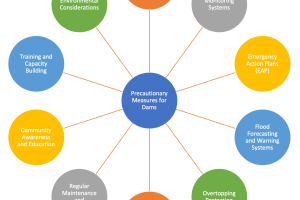
- Environmental disturbance should be minimum


